
YouTube
Perched atop Yinghanling, the highest ridge of Guanyinshan, this camera surveys one of the most rewarding panoramas in northern Taiwan. The volcanic mountain's silhouette is said to resemble a reclining Guanyin, the Buddhist goddess of mercy, watching over the Tamsui River estuary below. Hikers who complete the steep, chain-assisted final ascent are rewarded with sweeping views across the Taipei Basin toward the Taiwan Strait.
Everything you need to know about this live stream
Rising from the northern tip of the Taipei Basin, Guanyinshan is a cluster of extinct volcanic peaks whose jagged skyline, viewed from certain angles, is said to trace the reclining form of Guanyin, the Buddhist goddess of mercy. The range gives its name to the surrounding national scenic area, a protected stretch of forested slopes overlooking the mouth of the Tamsui River.
At 612 meters, Yinghanling is the highest point of the massif and the destination of one of northern Taiwan's most popular day hikes. Its nickname, roughly translated as "Hard Man's Ridge," comes from the final stretch of trail, where hikers pull themselves up a steep rock face using fixed iron chains before reaching the summit platform this camera overlooks.
From the summit, the view sweeps across the Tamsui River estuary, the fishing harbors of Bali District, and on clear days the distant towers of downtown Taipei. To the west, the ridge drops toward the Taiwan Strait, making Yinghanling a favored spot to watch the interplay of river, coastline, and open sea from a single vantage point.
The camera is operated by the North Coast and Guanyinshan National Scenic Area Administration, part of Taiwan's Tourism Administration, which maintains the trail network, viewing platforms, and conservation programs across the mountain. The peak's mix of volcanic geology, coastal forest, and cultural significance has made it a protected landmark for generations of hikers.
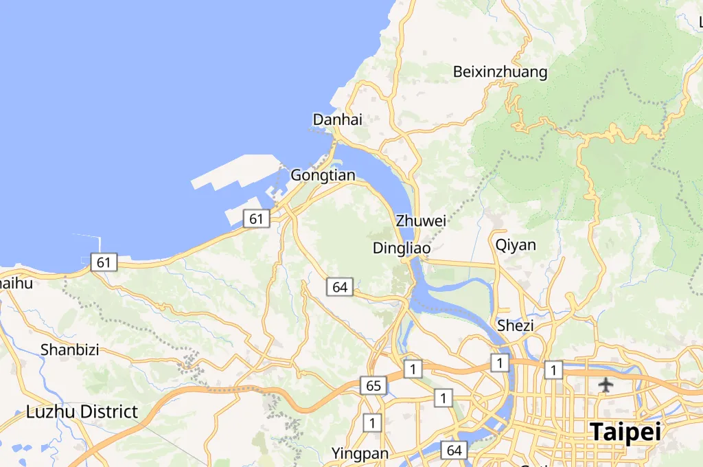
Click to Interact
Explore the interactive map
Explore other exciting destinations in the same or related category
 北觀國家風景區管理處