Onomichi Waterway from Senkoji Ropeway
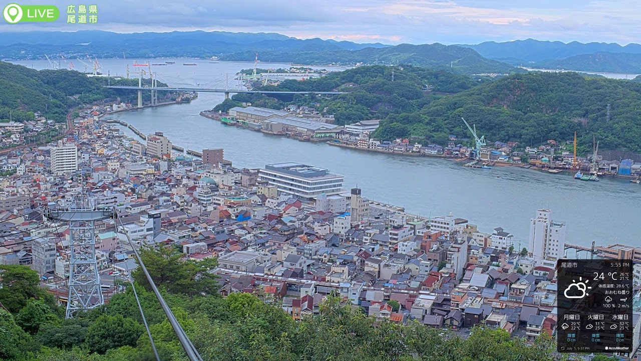
OnlineA commanding panorama over the Onomichi Waterway captured from the summit station of the Mt. Senkoji Ropeway. The tightly packed hillside city descends to the sea channel, where the Onomichi Ohashi and Shin-Onomichi Ohashi bridges arc toward Mukaishima island and the celebrated Shimanami Kaidō route. Ferries and cargo vessels trace the glassy strait framed by the ropeway cables.
About This Webcam
Everything you need to know about this live stream
The Onomichi Waterway Panorama
The camera looks down from the summit of Mt. Senkoji over the Onomichi Suidō, a narrow sea channel that threads between the mainland city and Mukaishima. Recognized as one of Japan's Japan Heritage landscapes, the strait is a working waterway where ferries, fishing boats and cargo ships pass in constant motion.
A City on the Hillside
In the foreground, the historic port town of Onomichi climbs the slope in a dense mosaic of rooftops, temples and narrow alleys. With roughly 1,200 years of history and dozens of surviving temples, the town is often called the "Nara of the West" and remains a favorite of writers and film-makers.
Bridges and the Shimanami Kaidō
Spanning the channel are the Onomichi Ohashi and the Shin-Onomichi Ohashi, the latter the gateway of the Shimanami Kaidō expressway that hops across seven islands toward Imabari on Shikoku, prized by cyclists worldwide.
The Mt. Senkoji Ropeway Vantage
Installed at the ropeway's summit station, the fixed 4K camera keeps the aerial cables within the frame, offering a stable, elevated vantage that surveys the whole basin from the ridgeline down to the far islands.
Location Details
Mt. Senkoji Ropeway
Onomichi, Hiroshima, Japan
Asia
Timezone
Tokyo
Asia/Tokyo (UTC+9)
GPS Coordinates
34.4106°, 133.1976°
Current Weather
© Open-MeteoInteractive Map - Mt. Senkoji Ropeway Area

LIVE CAM
Click to Interact
Explore the interactive map
Similar Webcams
Explore other exciting destinations in the same or related category