Maebashi Panorama from the Prefectural Office
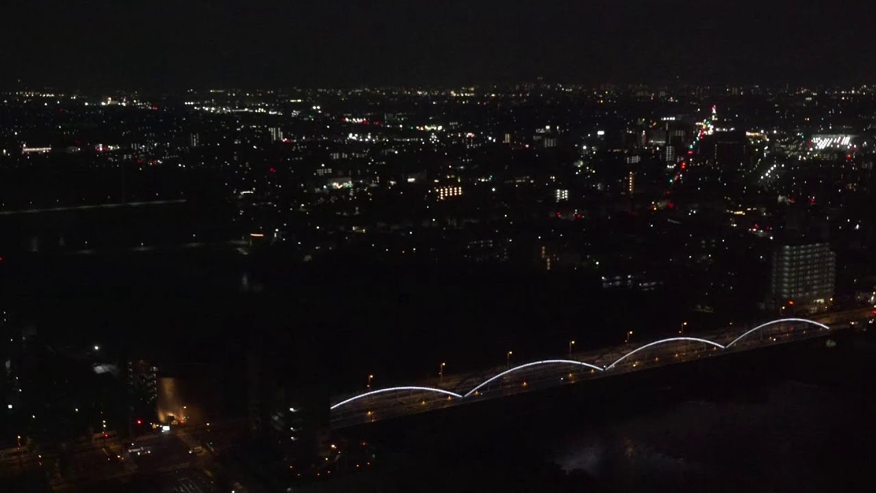
OnlineA sweeping panoramic view unfolds from the 32nd-floor observation deck of the Gunma Prefectural Government Office, the tallest tower for miles. The camera looks south across the densely built cityscape of Maebashi toward Takasaki, with the Tone River and the blue arch of Gunma Bridge threading the expansive Kanto plain.
About This Webcam
Everything you need to know about this live stream
A Commanding City Overlook
Perched atop the Gunma Prefectural Government Office, one of the tallest buildings in the region, this camera offers a rare elevated vantage over the capital of Gunma. The 32nd-floor observation hall — home to the tsulunos media studio — commands an unobstructed sweep of the surrounding plain.
The Tone River and Gunma Bridge
At the heart of the frame, the Tone River — the river with the largest drainage basin in Japan — carves across the landscape, spanned by the distinctive blue arch of the Gunma Bridge. The waterway anchors the view and traces the gentle geography between Maebashi and Takasaki.
Toward Takasaki and the Kanto Plain
Beyond the river, the twin cities of Maebashi and Takasaki spread across the broad Kanto plain, their streets, rail lines and rooftops receding toward the horizon. On clear stretches the mountains ringing the prefecture edge into view.
A Public Civic Feed
Operated directly by the Gunma Prefecture as part of its media-promotion programme, this is an authoritative civic feed — a living window onto the prefectural capital and the daily rhythm of central Gunma.
Location Details
Maebashi
Maebashi, Gunma, Japan
Asia
Timezone
Tokyo
Asia/Tokyo (UTC+9)
GPS Coordinates
36.3906°, 139.0603°
Current Weather
© Open-MeteoInteractive Map - Maebashi Area

LIVE CAM
Click to Interact
Explore the interactive map
Similar Webcams
Explore other exciting destinations in the same or related category