Oyodo River & Tachibana Bridge
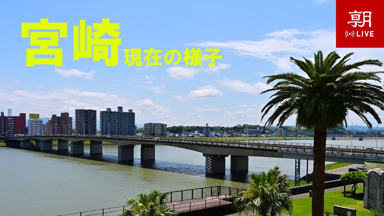
OnlineThe Oyodo River sweeps through the heart of Miyazaki, its broad, slow-moving waters reflecting the low city skyline on the far bank. The girder spans of the Tachibana Bridge, carrying National Route 220, stride across the channel while subtropical palms line the landscaped riverside promenade. This is a quintessential southern Kyushu waterfront, broadcast live by the Asahi Shimbun.
About This Webcam
Everything you need to know about this live stream
The Oyodo River Waterfront
The Oyodo is the principal river of southern Kyushu, rising in the mountains of the interior and emptying into the Pacific just east of this view. As it curves through central Miyazaki it widens into a broad, placid channel framed by grassy embankments, cycle paths and rows of palms that give the city its subtropical character.
Tachibana Bridge and Route 220
The steel Tachibana Bridge (橘橋) is one of the busiest crossings in the prefecture, carrying National Route 220 between the downtown core and the residential districts on the south bank. Its repeated girder spans and the slender pier markers in the water are an instantly recognisable part of the Miyazaki skyline.
A Southern Kyushu River City
Backed by mid-rise apartment blocks and office towers, the riverbank doubles as one of the city's favourite recreation corridors, busy with walkers, runners and anglers. The scene captures the relaxed, palm-lined mood that makes Miyazaki a popular gateway to Japan's warm south.
About the Live Stream
This camera is operated by the Asahi Shimbun from its Miyazaki Bureau, offering a continuous wide view of the river, the bridge and the surrounding city. A burned-in real-time clock confirms the feed is live.
Location Details
Oyodo River
Miyazaki, Miyazaki Prefecture, Japan
Asia
Timezone
Tokyo
Asia/Tokyo (UTC+9)
GPS Coordinates
31.9059°, 131.4205°
Current Weather
© Open-MeteoInteractive Map - Oyodo River Area

LIVE CAM
Click to Interact
Explore the interactive map
Similar Webcams
Explore other exciting destinations in the same or related category